
Morzine ski holiday booked, restaurants and bars picked to explore, ski gear out and ready to pack! All that’s left is to download Morzine piste maps and start planning some routes. You’ll find PDF piste maps for Morzine & Les Gets and the entire Portes du Soleil ski area, as well as a guide on how to use them, some recommendations, and where to go for your sturdy, dependable paper piste map. The Portes du Soleil and Morzine & Les Gets maps below are the official 2026/27 winter piste maps.
Morzine sits at the heart of a vast ski area known as the Portes du Soleil. With around 600 km of pistes, there’s plenty to explore. However, the region is also broken down into Morzine & Les Gets and Avoriaz, with ski pass options covering all 3 options, which is great for those skiers who like to stick a little closer to their accommodation or for those who love grand tours across the whole network. Find out more about the Morzine ski passes. Download the Morzine & Les Gets and Portes du Soleil piste maps below. Heading up to Avoriaz? Get the Avoriaz piste map 2026/27 on its own page.
Portes du Soleil Piste Map 2026/27
Morzine & Les Gets Piste Map 2026/27
Piste Map on Phone
The Portes du Soleil has a free app to help navigate your way around, perfect for when your paper version starts to fall apart by the end of the week. The app has some really great features, such as;
- Live Webcams & Lift Status
- ‘Locate Me’ service for when navigating the pistes, and an SOS function for emergencies
- Overlay of mountaintop facilities, such as restaurants & toilets.
- Weather and snow conditions
- Current avalanche risk
And for those keen to check out the slopes in summer, walking or with a bike through our sister company Atlas Ride Co, they have a summer version with many of the same features.
Where to collect in person
Guests at Atlas Ski Co’s catered or self-catered chalets will find a paper piste map in their arrival goodie bag, as well as in the chalets or through staff, however if you’re out and have misplaced one, the best option is to pick a new one up at the Lift Pass Offices or the Tourist Information Office.
Pleney Lift Pass Office
The Pléney Lift Pass Office can be found at the bottom of the Pléney bubble, which is the most recognisable ski lift in Morzine. It can be found on the south side of Morzine at the bottom of the Pléney slopes.
This office stocks the Morzine-Les Gets edition of the piste map (with the Portes du Soleil on the other side). You may find the Avoriaz edition here too but with a limited amount available.
Super Morzine Lift Pass Office
The Super Morzine Lift Pass office can be found next to the Super Morzine bubble next door to the suspension bridge.
This office stocks the Avoriaz edition of the piste map (with the Portes du Soleil on the other side). You may find the Morzine-Les Gets edition here too but with a limited amount available.
Using The Piste Map
Piste maps can be tough to read, especially when they have as much information as the Portes du Soleil one, owing to the fact that it is Europe's largest cross-border ski area!
Pistes & Snow Parks
Pistes are broken down into 4 categories indicating the difficulty of each run:
Green - Very Easy - Suitable for beginners and where ski schools will generally meet for the first week of lessons
Blue - Easy - Suitable for beginners and intermediates. Regularly groomed so always in good condition, and an excellent way to get around the resort quickly.
Red - Difficult - Suitable for intermediates & advanced skiers. Steeper in places and generally less maintained so users will have to be of a higher ability and confidence level to tackle some more unexpected sections.
Black - Very Difficult - Suitable for advanced & expert skiers. Steep, technical and rough. Some less experienced skiers with a steely resolve may tackle these steep slopes from time to time, but we wouldn’t recommend overstretching yourself and running the risk of ruining your holiday.
You’ll also find several Orange runs, which are Free Zones, meaning they’re a designated area for off-piste skiing, meaning they’re ungroomed and dependent on snow conditions. Snowparks are shown as an Orange bubble.
View from the lift
Ski Lifts - Navigating the Portes du Soleil
Identified by thick black lines on the piste map, as well as an icon showing what type of lift it is. They are also named which helps when setting meeting points.
Téléski
The drag lift, or button lift, these cover generally shorter distances and keep skiers on the ground, being dragged up the hill to the destination. Typically quite hard for beginners or snowboarders to use (although the cause of some brilliantly memorable moments), the Portes du Soleil has less of these than many other ski regions.
Télésiège
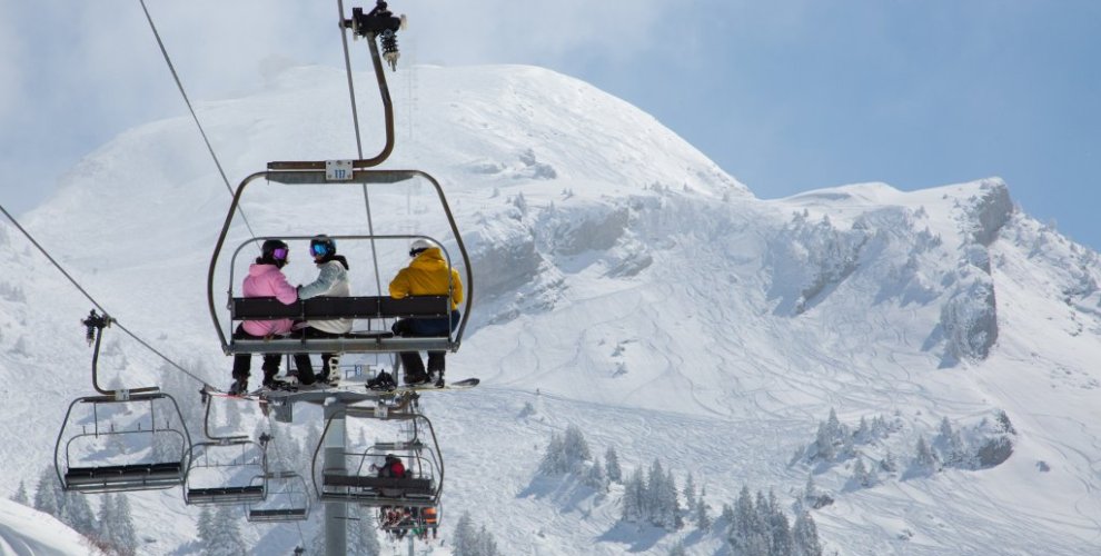
The Chairlift. The most common lift in ski resorts, they come in 2, 3, 4, 6, or 8 person capacities. Some are covered and fast, some are older and slower, but they are all pretty easy to use and will make up the majority of your travelling time when out on the slopes.
Télécabine
The gondola, bubble lift or cable car, these lifts will take you from the town to the top of the slopes. You will need to take skis or snowboard off to use.
Other Points of Interest
The Piste Map also highlights restaurants (knife and fork icon), meeting points (green and white diamond), viewing points (sun rise icon), mountain peaks (Triangle with name and altitude) and toilets (WC icon). The Swiss-French border is marked with a dotted line, so nice and easy to navigate across for an international lunch.